
California Zephyr
Sierra summits, desert canyons, and the Rockies — sea to lake on America's most scenic train.
- Route
- Chicago ↔ Emeryville
- Distance
- 3,924 km · 2,438 mi
- Audio stories
- 87
- In the app
- Both directions · Works offline
Watch the journey
A short film of the line — the views the guide narrates as they pass your window. English captions in the player.
Route map
Tap to explore the full route.
The route in text
- Route
- Chicago ↔ Emeryville, USA
- Distance
- 3,924 km · 2,438 mi
- Audio stories
- 87, narrated in both directions of travel, fully offline
- On the map
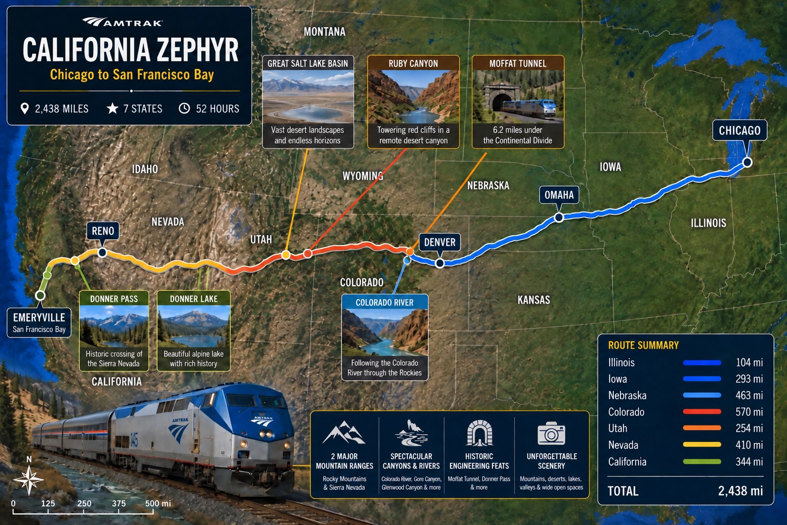
- Illustrated route map of the California Zephyr with stations, distances, and journey highlights. Station names and distance markers are printed on the map itself.
About this journey
Ride along on Amtrak's California Zephyr between the San Francisco Bay and Chicago: over the Sierra Nevada at Donner Pass, across the Nevada desert, through the red-rock canyons of Utah and Colorado, under the Continental Divide via the Moffat Tunnel, and over the Great Plains. This audio guide narrates the sights as they appear outside your window, in either direction of travel.
As on every route, stories are triggered by GPS as you reach each place, play in either direction of travel, and work fully offline once you've downloaded the journey. The app even tells you which side of the train to look.


